The Cities · Île-de-France · city
Paris Below the Monuments
The city's real texture is not in its skylines but in its connective tissue — the streets that go nowhere famous, the covered passages, the canal basin at dusk.
Filed at
10A queue is part of the visit.
The city's real texture is not in its skylines but in its connective tissue — the streets that go nowhere famous, the covered passages, the canal basin at dusk.
What the Itinerary Misses
Every first-time visitor to Paris arrives with a mental map assembled from photographs, and that map is almost entirely vertical. The Eiffel Tower, the dome of Sacré-Cœur, the Gothic verticals of Notre-Dame — these are images made from a distance, from elevated ground, from the far bank of a river. They are real, and some of them are extraordinary. But they describe a city seen from outside itself, and the Paris that lives inside itself operates almost entirely at ground level, in horizontal registers: the width of a pavement, the angle at which morning light crosses a zinc bar counter, the way a covered passage funnels pedestrian life away from the boulevard outside.
The argument here is simple: the most durable impression of Paris comes not from its monuments but from the intervals between them — the streets that connect rather than arrive, the arrondissements that photograph badly and live well, and the Canal Saint-Martin network, which rewards the visitor who just walks alongside it without consulting anything.
The Steps, the Passages, the Basin
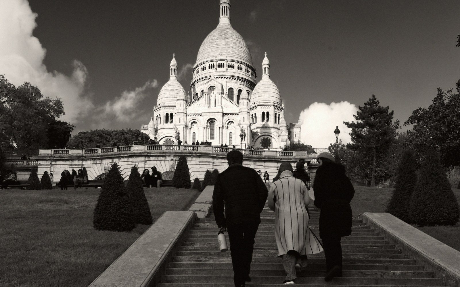
Start, if you want a way in, with the steps below Sacré-Cœur. The basilica itself, late nineteenth-century Romano-Byzantine confection built on a political as much as a spiritual logic, sits at the top of the Butte Montmartre in a way that was always about visibility — the church as white flag raised over the city after the Commune. Almost everyone climbs to look at it or from it. What repays attention is the network of steps that descend from the butte into the 18th arrondissement proper: the Rue Foyatier, the steep cut of the Rue du Chevalier-de-la-Barre, the passages and dead-ends that fold back toward the Boulevard de Rochechouart. These are not scenic routes in any conventional sense. They are workaday streets, heavily used, full of the particular density of a Paris neighbourhood that has never been fashionable in the way Montmartre's tourist zone is. That density — hardware shops, halal butchers, produce stalls that start early and end late — is precisely what the queue outside the basilica misses.
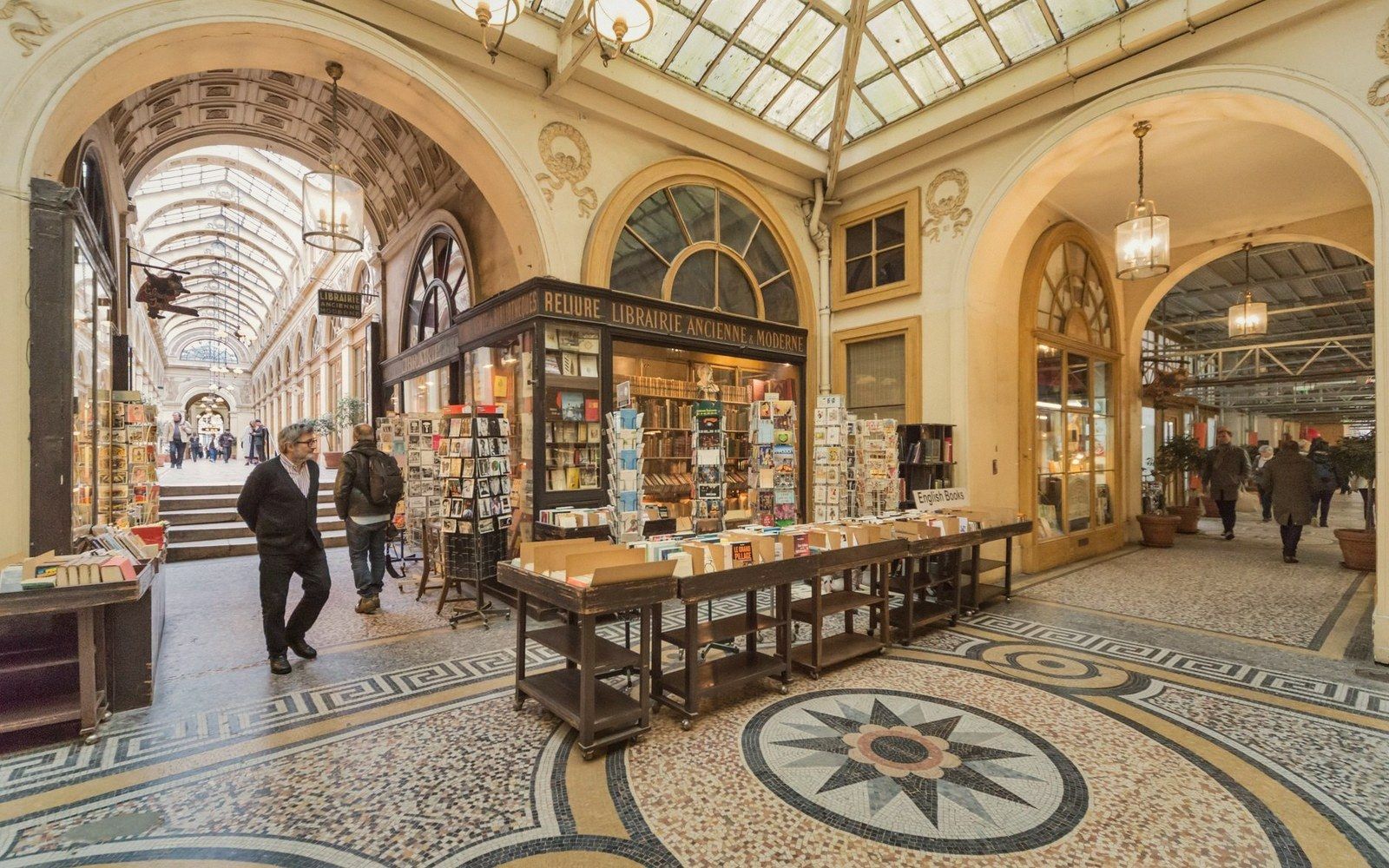
The covered passages of central Paris are better known than they used to be, but still underused as a way of moving through the city rather than visiting. The passages couverts — covered arcades, mostly built during the first half of the nineteenth century before Haussmann remade central Paris with his great boulevards — were commercial streets protected from the weather, roofed in iron and glass. Many were demolished. The ones that survived, scattered mainly through the 2nd and 9th arrondissements, form a fragmentary network that a determined walker can thread together over an afternoon: the Galerie Vivienne with its elaborate mosaic floor, the Passage Jouffroy with its waxworks museum and toy shops, the Passage des Panoramas, which retains the feel of a place that time edited rather than restored. None of these is empty of tourists, but none is overwhelmed by them either, partly because they offer nothing spectacular — no single image worth stopping for — just the sustained pleasure of being inside something old and slightly impractical.
What connects them, if you walk rather than Metro, is the grain of the 2nd arrondissement itself: narrow streets, printing trade survivors, restaurants that open for the lunch trade and go quiet by two. Paris has a daytime rhythm that the monuments obscure. A city of two million people in a tight perimeter, it runs at a different pace between ten in the morning and two in the afternoon — a pace that manifests most clearly in the streets around the old trade districts, where the logic of the street is still economic and pedestrian rather than touristic.
The passages at a glance4 entries
- Passage des Panoramasoldest surviving covered arcade in Paris, 2nd arrondissement
- Galerie Viviennenotable for its mosaic floor and Neo-Grec ironwork, 2nd arrondissement
- Passage Jouffroywaxwork museum, toy and book dealers, 9th arrondissement
- Passages couvertsgeneral term for the nineteenth-century covered arcades; most survivors are north of the river near the grands boulevards
Water and the Northern Districts
The Canal Saint-Martin has been photographed into cliché — iron footbridges, plane trees, locks — but it earns its reputation by being genuinely pleasant to walk and genuinely Parisian in the sense that actual Parisians use it. It runs for about four and a half kilometres from the Arsenal basin near the Bastille, goes underground for a stretch beneath the Place de la Bastille and the Boulevard Richard-Lenoir, resurfaces near the Place de la République, and continues north through the 10th arrondissement before feeding into the Canal de l'Ourcq at the Bassin de la Villette, the largest artificial lake in Paris.
The Bassin de la Villette, between the Jaurès and Stalingrad Métro stations, is where the city's relationship with its canal network becomes something other than a backdrop. The basin is wide enough to feel like an inland harbour. Péniches — the wide flat-bottomed canal barges — are moored along both banks, some of them long-term residences, some cultural spaces, some simply boats. In summer the quais become an outdoor leisure area with some vigour; in the colder months, when the tourist radius contracts back toward the river, the basin settles into something less performed. The surrounding streets — the 10th and 19th arrondissements pressing against each other — are among the more economically mixed in the city, and the mix is visible in the commerce along the water: West African grocers, Vietnamese pho canteens, wine bars that opened in the last ten years alongside tabacs that have not changed in thirty. This is not a description of authenticity in the precious sense. It is simply a description of what a working urban neighbourhood looks like when it has not been fully valorised — the planning term for the process by which a district becomes aspirational and expensive and begins to resemble a photograph of itself.
Paris rewards the visitor who treats the gap between one famous thing and another as the actual destination.
How to Use This
None of this requires special effort or unusual preparation. It requires walking further than the itinerary suggests and using the Métro as a starting point rather than a destination. The Paris Métro — opened in 1900, now covering more than two hundred kilometres of track — is efficient enough that most visitors use it to arrive and depart from the main sights without walking the distances between them. Walking those distances changes the city. The 20th arrondissement is not far from Père-Lachaise in the sense that most visitors understand distance; it is twenty minutes on foot from the cemetery's eastern gate, through streets that the cemetery's fame entirely eclipses. The Goutte d'Or neighbourhood, immediately east of the Barbès-Rochechouart interchange, is contained within what tourists would regard as the Montmartre orbit and is almost entirely invisible to them.
Paris rewards the visitor who treats the gap between one famous thing and another as the actual destination. The covered passages are a structural version of this — they were always routes, never endpoints — and the canal network is another. The steps of Montmartre descend toward something more interesting than the view they lead up to. The key adjustment is attentional rather than logistical: less time deciding where to go, more time noticing what a particular street is actually doing. Paris is not subtle about this. It offers its connective tissue plainly, at pavement level, to anyone who has stopped looking upward.
Canal geography4 entries
- Canal Saint-Martinruns roughly 4.5 km; partially underground beneath Place de la Bastille and Boulevard Richard-Lenoir
- Bassin de la Villettelarge artificial lake fed by the canal; sits between Jaurès and Stalingrad Métro stations
- Canal de l'Ourcqcontinues north and east from the basin toward the Seine-Saint-Denis suburbs
- Pénicheswide flat-bottomed river and canal barges; many moored permanently along the Villette basin