The Empty Diagonal · Lozère and Gard · range
Into the Cévennes the Long Way
The southern approach is the popular one. The northern way in — through granite upland and wolf country — earns what follows.
Filed at
2You will pass a car occasionally.
The southern approach is the popular one. The northern way in — through granite upland and wolf country — earns what follows.
From the Margeride Down
Most visitors arrive at the Cévennes from below: Nîmes or Montpellier, the garrigues giving way to the first chestnuts, the valleys deepening quickly. It works. But the northern approach — entering the massif through the Margeride plateau and then crossing the Lozère into the high Cévennes — is a different kind of preparation. It lets the landscape build its argument slowly.
The Margeride is granite country at around 1,200 to 1,400 metres, treeless enough to read as almost Scandinavian in winter light. The road through here — typically from Saint-Flour south and west toward Marvejols or Langogne — crosses a plateau that belongs temperamentally to the Aubrac rather than to anything Mediterranean. Cattle graze on rough pasture, wind turbines stand on the ridgelines, and the villages are built low and dark in the local granite. Nothing is decorative. The Margeride was the site of some of the bloodiest Resistance activity in the south during the Second World War; the memorials are plain and numerous.
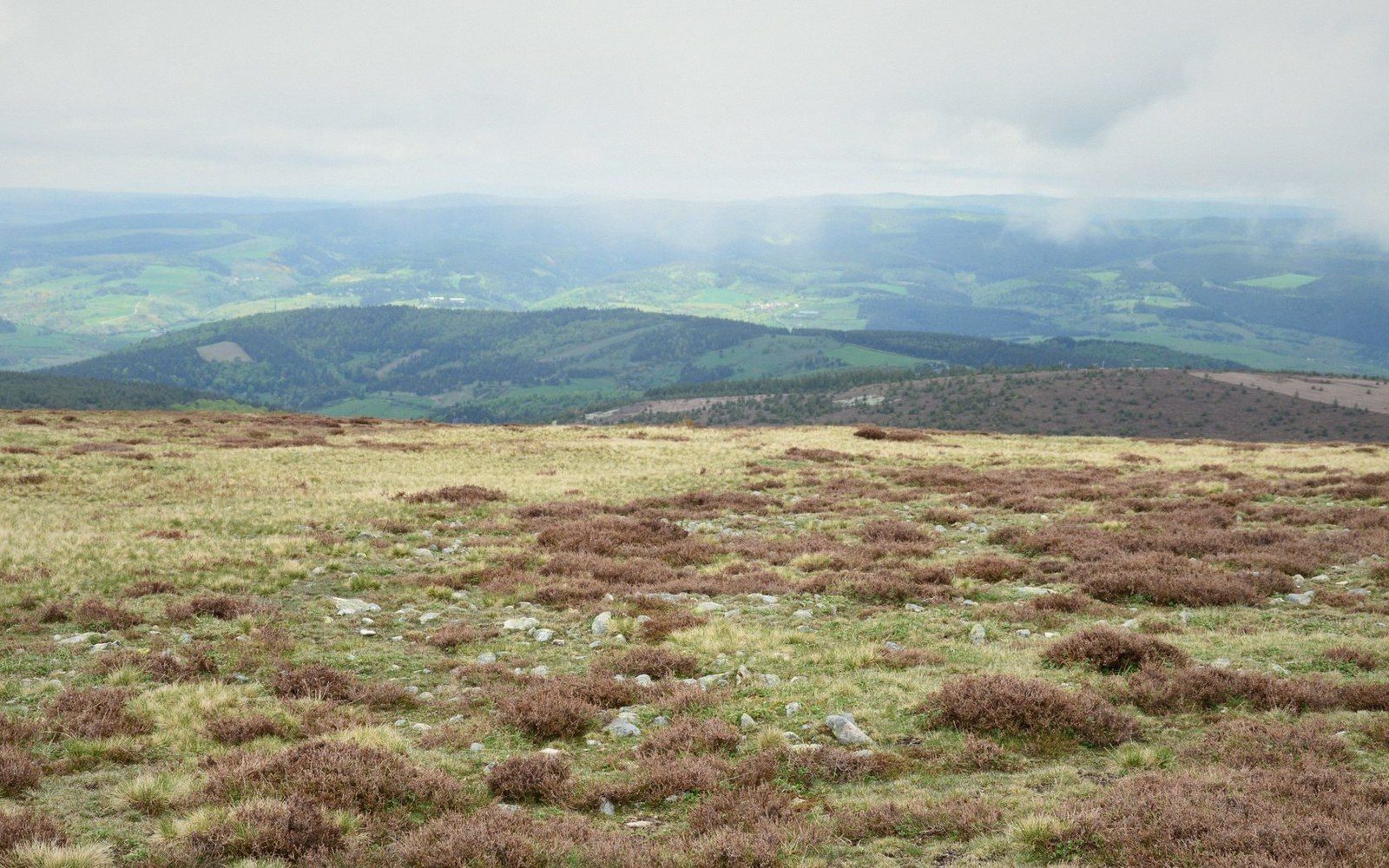
Past Marvejols the ground begins to shift. The Lot river cuts west through shallow gorges, and the city of Mende — the smallest cathedral city in France by diocese population — anchors the valley before the road climbs again onto the Lozère plateau proper. The Mont Lozère, a great rounded granite massif, is the highest ground in the Cévennes range and catches weather from both Atlantic and Mediterranean systems, which is why it feels like neither. On a clear day the summit plateau is open and almost featureless: low stone walls, boggy ground, occasional herds of semi-wild horses. On a bad day it is entirely inside cloud.
The geography in brief4 entries
- Margeride plateaugranite upland, roughly 1,200–1,400 m, north of the Cévennes proper; pastoral and exposed
- Mont Lozèrehighest point of the Cévennes range; watershed between Atlantic and Mediterranean drainage
- Floracvalley town, Cévennes National Park; the natural landing point of this northern route
- Mendemain city of the Lozère département; smallest cathedral city in France by diocese population
Where the Landscape Changes Register
The change happens south of Mont Lozère. Below the watershed, everything orients toward the Mediterranean. The chestnuts start — enormous, ancient, planted across centuries as a subsistence crop so foundational that the chestnut was once called l'arbre à pain, the bread tree. The valleys tighten and deepen into the classic Cévenol form: steep schist walls, a thread of river at the bottom, terraced slopes held by dry-stone walls called bancels that take generations to build and a single bad season to lose.
Florac is where this northern approach lands. It sits at the junction of the Tarnon valley and the Gorges du Tarn, inside the Cévennes National Park — established in 1970, one of France's largest — and it reads as a working market town before it reads as a tourist one. The Stevenson Trail, the long-distance walking route that follows Robert Louis Stevenson's 1878 donkey journey through the Cévennes, passes through the area; the park's visitor infrastructure clusters here and at Le Pont-de-Montvert to the north-east.
What the northern approach gives you that the southern one doesn't is a sense of the range as a climatic and geological boundary rather than simply a scenic one. You've crossed from Atlantic-influenced granite plateau through an exposed Alpine-feeling watershed into a valley system that smells of lavender and chestnut in the same week. The Cévennes are not a single place. They are a gradient, and this way of entering them makes that visible from the start.
Two terms worth knowing2 entries
- bancelsdry-stone terraced walls that define the cultivated Cévenol valley sides; centuries of labour visible in the landscape
- l'arbre à pain"the bread tree"; the chestnut as described historically, underlining how dependent valley populations were on the crop
The Margeride is granite country at around 1,200 to 1,400 metres, treeless enough to read as almost Scandinavian in winter light.